It's been awhile since I've posted! I don't have much to say other than I was in Los Angeles in late October with TVN while they did their promotional tour. We had a blast! It's almost winter time, so hibernating is probably what I'll be doing until spring. I'll occasionally post some photos of this year, if I have time. This blog will eventually be dead whenever we get the new website up.
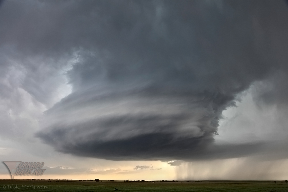
Below is a photo I shot of a beautiful supercell in Eastern Colorado on June 10th of this year. (If you look closely in the foreground, you'll see Robert Seaman filming for the Storm Chasers show) This is why I chase.
Edit: The Facebook link on the right doesn't work right now......I've temporarily deactivated my account until the first chase of the season.